
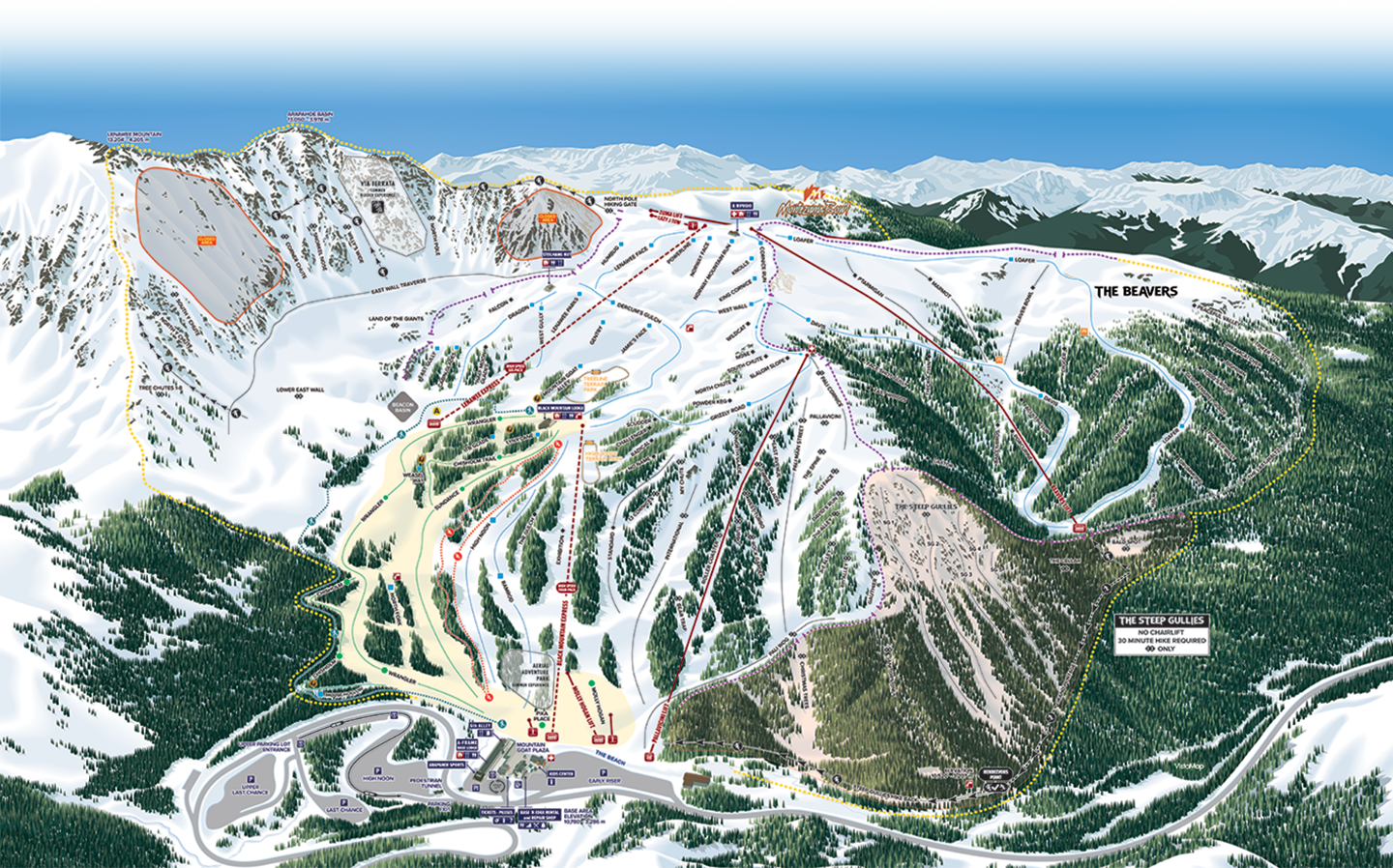
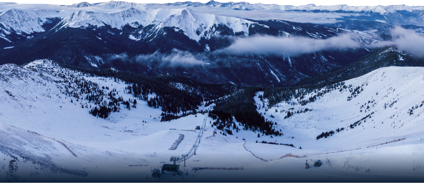
AREAS TO EXPLORE
Arapahoe Basin has seven distinct areas. Get an insider's understanding of our mountain with our virtual mountain tour video series, guided by some of our longtime staff.
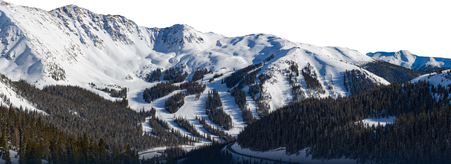
A-Basin’s front side terrain offers a little of everything, from the most casual runs to advanced moguls to the three terrain parks. Most of A-Basin’s intermediate routes and all on-mountain beginner runs are accessed via this area’s Black Mountain Express and Lenawee lifts. The Legend’s front-side skiing and riding is still a big-mountain experience. Two, short lift rides and you’re at 12,500 feet—above treeline at the top of the lift-served terrain—exploring wide-open intermediate groomers and introductory glade runs. The front side lifts also offer access to the rest of the mountain areas, making A-Basin extremely easy to navigate.


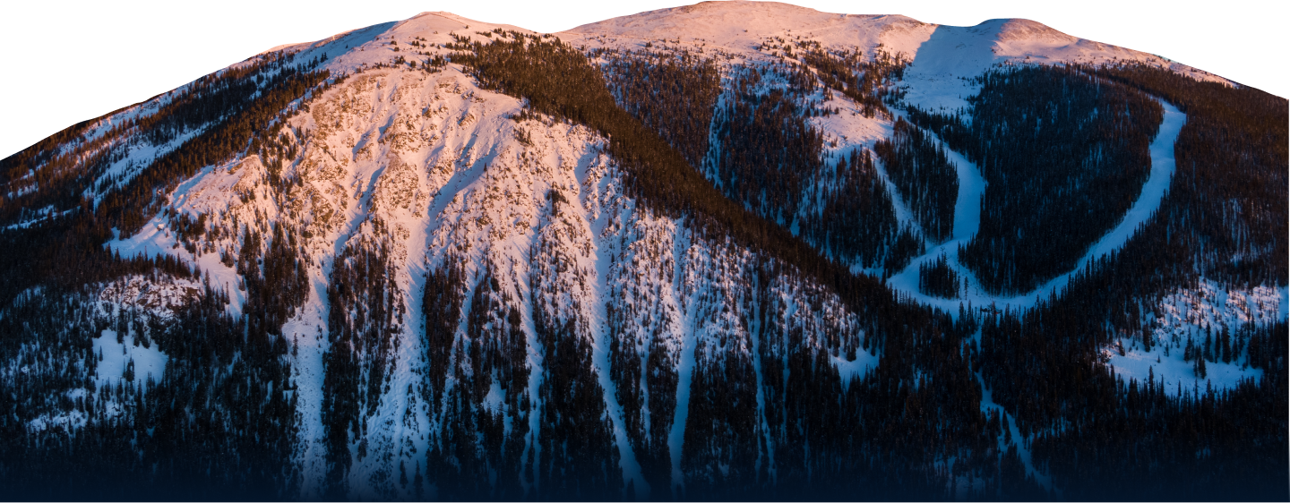
The Pallavicini area is A-Basin’s legendary, front-side advanced and expert terrain. Served by a lift of the same name, the primarily double-black Pallavicini runs are accessible directly from the base area with a single lift ride. Don't miss The Spine, one of our favorite runs on the mountain. Pallavicini has also been hosting the A-Basin Enduro for 30 years. During the event, teams of two ski and ride as many runs as possible off the “Pali Chair” over 10 consecutive hours to help raise funds for a community member in need.
The Beavers is 300+ acres added in the 2017-18 season. Combined with The Steep Gullies, it grew A-Basin’s skiable terrain by nearly 50 percent. Construction was done with minimal environmental impact and completed the vision A-Basin’s founders had back in 1946. A quad lift gives you access to 36 runs in The Beavers, including rolling intermediate groomers, open bowls, steep chutes and some of the best glades and powder stashes in the state.
“Zuma” is A-Basin’s south-facing backside bowl. It offers stunning mountain scenery including views of multiple 14,000-foot peaks. The terrain is home to 400 acres of wide-open intermediate groomers, well-spaced trees and rocky cliffs. A small hike-back zone below the lift almost always guarantees great snow and solitude.
The Steep Gullies was added, along with The Beavers, for the 2017-18 season. This terrain was once backcountry, and bringing it into ski area boundaries was a way to offer it to guests much more safely by patrolling the area and doing avalanche mitigation. The Steep Gullies is as-advertised and features expert-only terrain comprised of steep, narrow, and rocky chutes. This is some of the most challenging in-bounds terrain you'll find in all of Colorado. Skiing or riding it requires serious skills and commitment, followed by a 20-30 minute hike back to the base area.
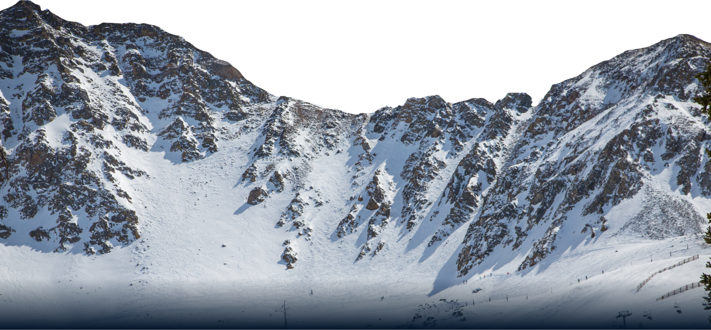
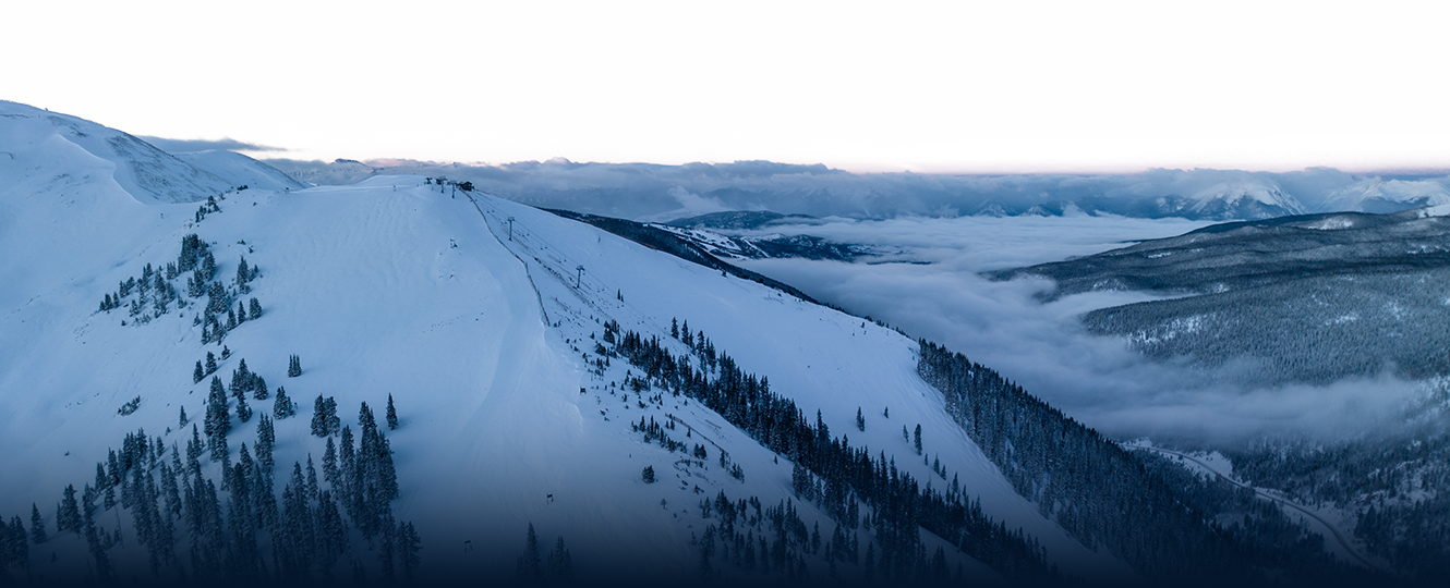
A-Basin is an adventurous mountain and to hike the East Wall is to experience one of The Legend’s biggest adventures. Make your way to 13,050 feet to enjoy the ski area’s most iconic views and some of its most extreme terrain. Access the East Wall chutes with just two, short lift rides, then use the hiking and bootpacking routes to spend an entire day (or lifetime) exploring.

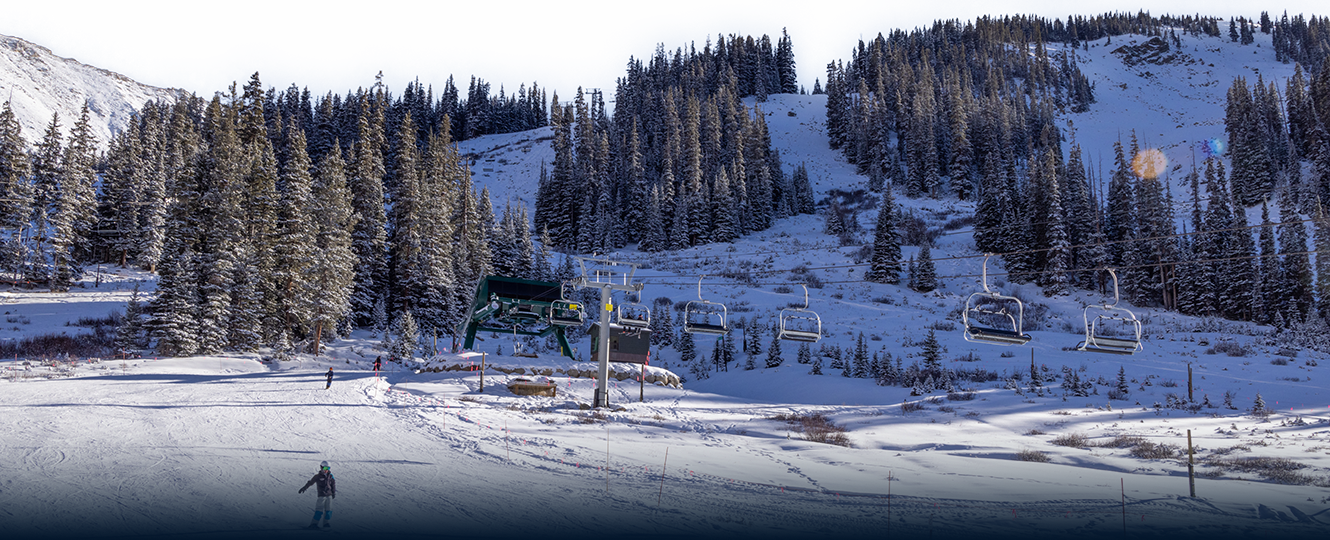
If you are new to A-Basin and new to skiing/riding, welcome! Check out this video for a tour of our parking, base-area, and learning hill. The overview will give you confidence to know your way around and have a great day on the mountain. Molly Hogan is A-Basin’s learning hill at the base of the mountain. Easily accessible from the lodge, Snowsports headquarters and the rental shop, the area is served by two magic carpets and one lift. Molly Hogan has welcomed multiple generations of fresh faces to The Legend not just teaching them to slide on snow, but transforming them into skiers and snowboarders. When you learn to ski or ride here, you can ski or ride anywhere!